
Harpers Ferry is a historic town in Jefferson County, West Virginia, in the lower Shenandoah Valley. The town's population was 269 at the 2020 United States census. Situated at the confluence of the Potomac and Shenandoah rivers, where Maryland, Virginia, and West Virginia meet, it is the easternmost town in West Virginia as well as its lowest point above sea level.

The National Road was the first major improved highway in the United States built by the federal government. Built between 1811 and 1837, the 620-mile (1,000 km) road connected the Potomac and Ohio Rivers and was a main transport path to the West for thousands of settlers. When improved in the 1830s, it became the second U.S. road surfaced with the macadam process pioneered by Scotsman John Loudon McAdam.

Huntington is a city in Cabell and Wayne counties in the U.S. state of West Virginia. The seat of Cabell County, the city is located at the confluence of the Ohio and Guyandotte rivers in the state's southwestern region. The population was 46,842 at the 2020 census, and was estimated to be 45,325 in 2023. Huntington is the second-most populous city in West Virginia. The Huntington–Ashland metropolitan area, spanning seven counties across West Virginia, Kentucky and Ohio, had an estimated population of 368,262 in 2023.

Mount Jackson is a town in Shenandoah County, Virginia, United States. The population was 1,994 at the 2010 census.

Thurmond is a town in Fayette County, West Virginia, United States, on the New River. The population was five at the 2020 census. During the heyday of coal mining in the New River Gorge, Thurmond was a prosperous town with a number of businesses and facilities for the Chesapeake and Ohio Railway.

Paw Paw is a town in Morgan County, West Virginia, United States. The population was 410 at the 2020 census. The town is known for the nearby Paw Paw Tunnel. Paw Paw was incorporated by the Circuit Court of Morgan County on April 8, 1891, and named after pawpaw, a wild fruit that grows in abundance throughout this region. On September 14, 2024 a group of local citizens organized by Maria Gloyd hosted the inaugural Pawpaw Festival in the Town Park. Hundreds of people attended the festival to hear lectures on how to grow and cultivate Pawpaw fruit, and listen to Appalachian music performed by the Paw Paw Community Choir, Ben Townsend, the Critton Hollow String Band, and Mary Hott with the Carpenter Ants. Paw Paw is the westernmost incorporated community in Morgan County, and the Hagerstown-Martinsburg, MD-WV Metropolitan Statistical Area.

Wheeling is a city in Ohio and Marshall counties in the U.S. state of West Virginia. The county seat of Ohio County, it lies along the Ohio River in the foothills of the Appalachian Mountains within the state's Northern Panhandle. As of the 2020 census, the city had a population of 27,062, making it the fifth-most populous city in West Virginia and the most populous in the Northern Panhandle. The Wheeling metropolitan area had a population of 139,513 in 2020. Wheeling is located about 60 miles (97 km) west of Pittsburgh and 120 miles (190 km) east of Columbus via Interstate 70.

The National Register of Historic Places in the United States is a register including buildings, sites, structures, districts, and objects. The Register automatically includes all National Historic Landmarks as well as all historic areas administered by the U.S. National Park Service. Since its introduction in 1966, more than 97,000 separate listings have been added to the register.

The Parkersburg Bridge crosses the Ohio River between Parkersburg, West Virginia, and Belpre, Ohio. Designed by Jacob Linville, the bridge has 46 spans: 25 deck plate girder, 14 deck truss, 6 through truss, and 1 through plate girder. 50,000 cubic yards (38,000 m3) of stone were used for the 53 piers. The bridge was constructed from May 1869 to January 1871 by the Baltimore and Ohio Railroad. At the time of its completion, the bridge was reportedly the longest in the world at 7,140 feet (2,180 m).

Charleston station is an active intercity railroad station in Charleston, Kanawha County, West Virginia. Located on MacCorkle Avenue Southeast, the station services trains of Amtrak's Cardinal between New York Penn Station and Chicago Union Station. The two trains, make stops in Charleston on Wednesdays, Fridays and Sundays. Charleston station contains a single 800-foot (240 m) concrete side platform and has a station depot that provides a waiting room for customers.

The King Iron Bridge & Manufacturing Company was a late-19th-century bridge building company located in Cleveland, Ohio. It was founded by Zenas King (1818–1892) in 1858 and subsequently managed by his sons, James A. King and Harry W. King and then his grandson, Norman C. King, until the mid-1920s. Many of the bridges built by the company were used during America's expansion west in the late 19th century and early 20th century, and some of these bridges are still standing today.

The Aetnaville Bridge is a through truss bridge spanning the back channel of the Ohio River between Bridgeport, Ohio and Wheeling, West Virginia. The bridge was built in December 1891 and used for vehicular traffic until December 1988, when it was closed to cars due to safety concerns. The structure was used by pedestrians until its complete closure in 2016.

Interstate 70 (I-70) is a portion of the Interstate Highway System that runs from near Cove Fort, Utah, at a junction with I-15 to Baltimore, Maryland. It crosses the Northern Panhandle of West Virginia through Ohio County and the city of Wheeling. This segment is the shortest of all states through which I-70 passes, crossing West Virginia for only 14.45 miles (23.26 km). The Fort Henry Bridge carries I-70 from Wheeling Island across the Ohio River and into downtown Wheeling before the freeway enters the Wheeling Tunnel. I-470, a southerly bypass of Wheeling and the lone auxiliary Interstate Highway in West Virginia, is intersected near Elm Grove. Before crossing into Pennsylvania, I-70 passes The Highlands, a major shopping center in the panhandle, and the Bear Rocks Lake Wildlife Management Area. On average, between 27,000 and 53,000 vehicles use the freeway every day.

This is a list of the National Register of Historic Places listings in Belmont County, Ohio.

The S Bridge is a historic stone arch bridge, spanning Salt Fork about 4 miles (6.4 km) east of Old Washington, Ohio. Built in 1828, it is one of the best-preserved surviving bridges built for the westward expansion of the National Road from Wheeling, West Virginia to Columbus, Ohio. S bridges derive their name from the sharply curving approaches to the span. The bridge was designated a National Historic Landmark in 1964. The bridge is closed to traffic, and may be seen from Blend Road on the north and Rhinehart Road on the south.
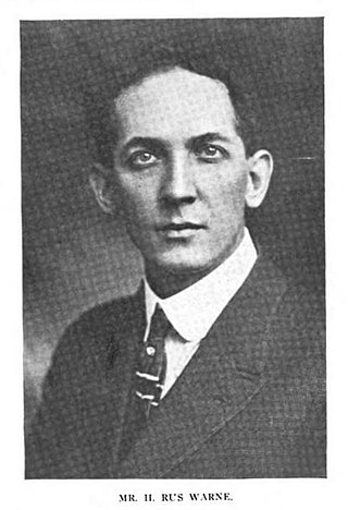
Harry Rus Warne was a Charleston, West Virginia-based architect.

Elm Hill, also known as the Campbell-Bloch House, is a historic house and national historic district located near Wheeling, Ohio County, West Virginia. The district includes two contributing buildings and one contributing site. The main house was built about 1850, and is a 2+1⁄2-story, brick house with a low 2-story wing in the Greek Revival style. It has an L-shaped plan, a 3-bay entrance portico, and hipped roof with an octagonal bell-cast central cupola. The interior has a central formal hall plan. Also on the property are a contributing brick, spring house / smoke house and a small cemetery dating to about 1835.

Wheeling Warehouse Historic District is a national historic district located at Wheeling, Ohio County, West Virginia. The district includes 20 contributing buildings and 11 contributing structures. They are warehouses and commercial style buildings and structures between Main Street and the Ohio River. All of the buildings date to the late-19th and early-20th century. The warehouses are mostly two- and three-story masonry buildings. The two-story commercial buildings have storefronts on the first floor and residential units above. Notable buildings and structures include the Pump Store (1933), Wheeling Stamping Plant (1932), Allied Plate Glass, Warwick China, Boury Warehouse, Ott-Heiskell Company, Edward Wagner Wholesale Grocers building (1915), the Moderne style former Greyhound Bus Station, and Main Street Bridge (1891).

The Church Hill Road Covered Bridge is a covered bridge in Columbiana County, Ohio. It was originally located over Middle Fork Little Beaver Creek in Elk Township. The bridge was constructed in 1870 and was relocated in 1982 behind a now closed restaurant on Ohio State Route 154 in Elkton, Ohio.


